Day 151 – off the beaten path

September 1, 2016

Crater Creek to Iceberg Lake

Miles: 12.8 (4.1 PCT/JMT miles)

Our total miles: 2273

As long as it isn’t raining we enjoy sleeping with no rain fly so we can gaze at the stars as we fall asleep.

Laurie tossed and turned all night like a rotisserie chicken. She got all twisted in her silk liner which made matters worse. 

At 2 am it got cold. Laurie was half asleep and too lazy to get her hat out of her sleeping bag at her feet. So instead she continued to toss and turn. 

At some point Andy woke up and offered Laurie his fleece. She put it over her head and instantly was warmer. We both slept better until 6:30 when our neighbors started rustling around.

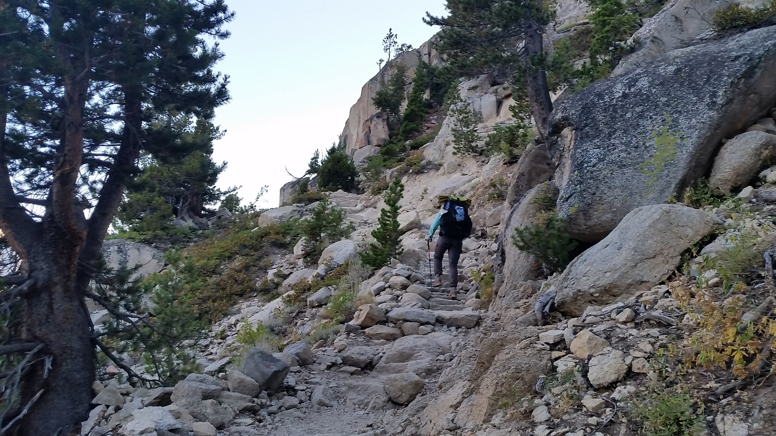
We packed up with gloves and down jackets on and were walking by 7:30. It was at least 10 degrees warmer when we got into the trees and away from the creek.

Andy realized last night as we descended into camp that it might be cold. We would be near a meadow and a creek. Cold air tends to sit in these places. Next time we should look at a map instead of just mileage to prevent camping in an ice box.

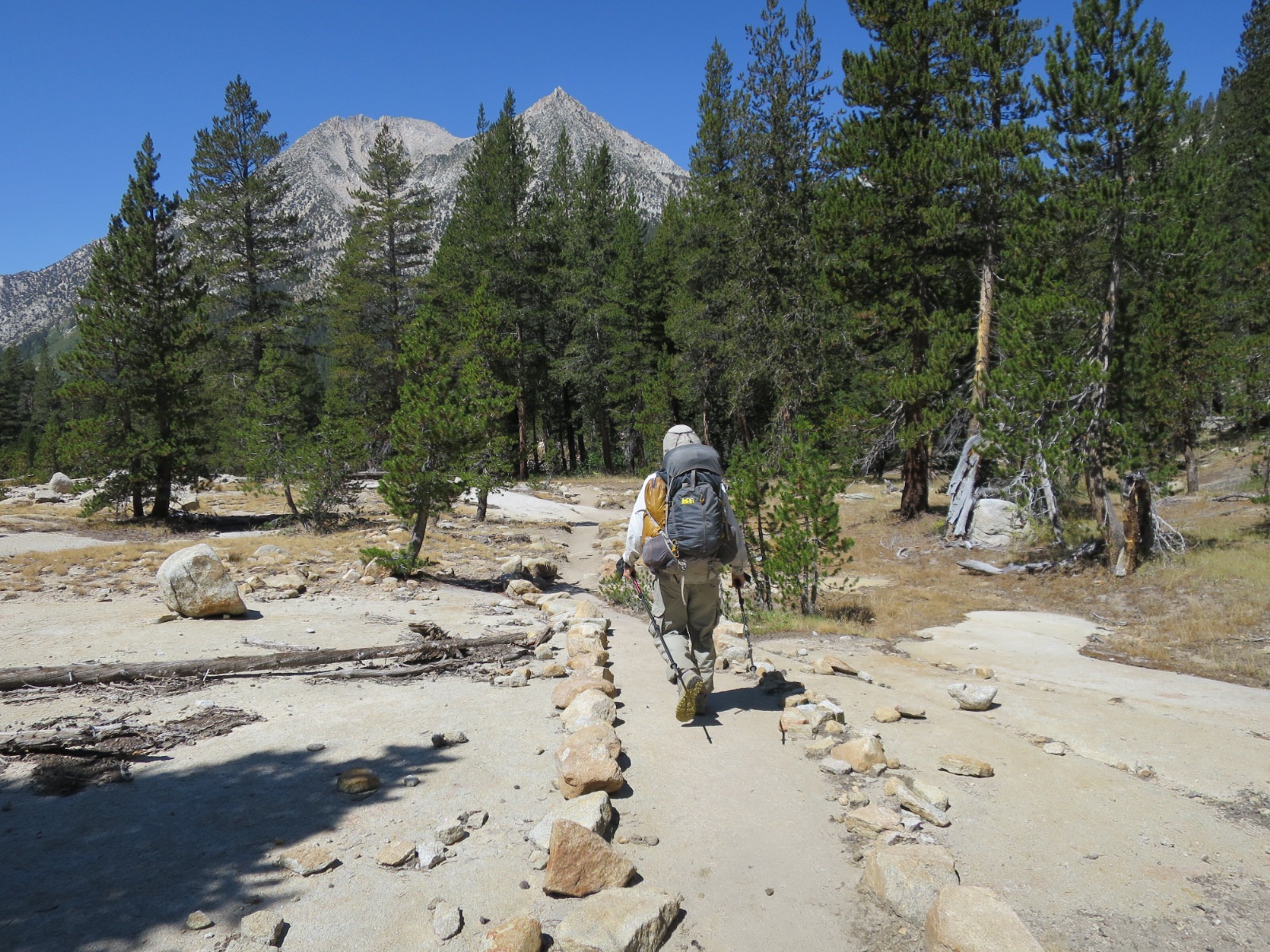
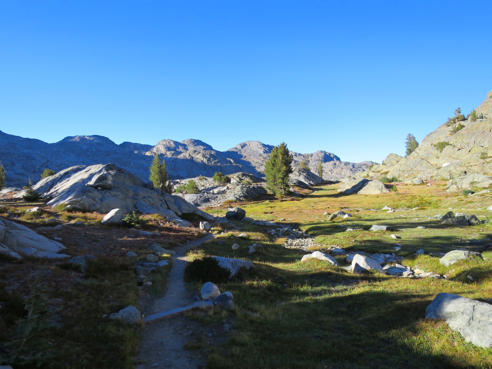
We switchbacked down the dusty trail watching the morning light illuminate the hillsides on the other side of the valley. As we neared the bottom of the valley we entered an old burn area.

Majority of the burned trees were missing their tops. In 2012 there was a huge wind storm that tore through this area with winds up to 150 mph. We assumed these topless trees were a result of that storm. 

We got to Red’s Meadow around 8:30. Andy found a table in the restaurant next to an outlet and we set up shop charging all of our electronics. 

Because it had gotten so cold, our camera and Laurie’s iPhone had considerably less charge than they had the night before. 

We enjoyed hot water as we ate our eggs, potatoes and sausage. The food was ok. While grateful for freshly cooked food, we’ve had way better for much less!

At 9:45, while working on the blog we shared a vanilla milkshake. Laurie had been looking forward to this milkshake for days but because this morning was so cold she had started to change her mind. Once warmed by many cups of hot water however, the twinkle in her eyes returned.

At 11:00 we left Red’s Meadow heading for Minaret Lakes. We took a detour up to the top of Devils Postpile. The Postpile is a rock formation consisting of many hexagonal rocks. The top looked like a honeycomb. Nature is so cool!

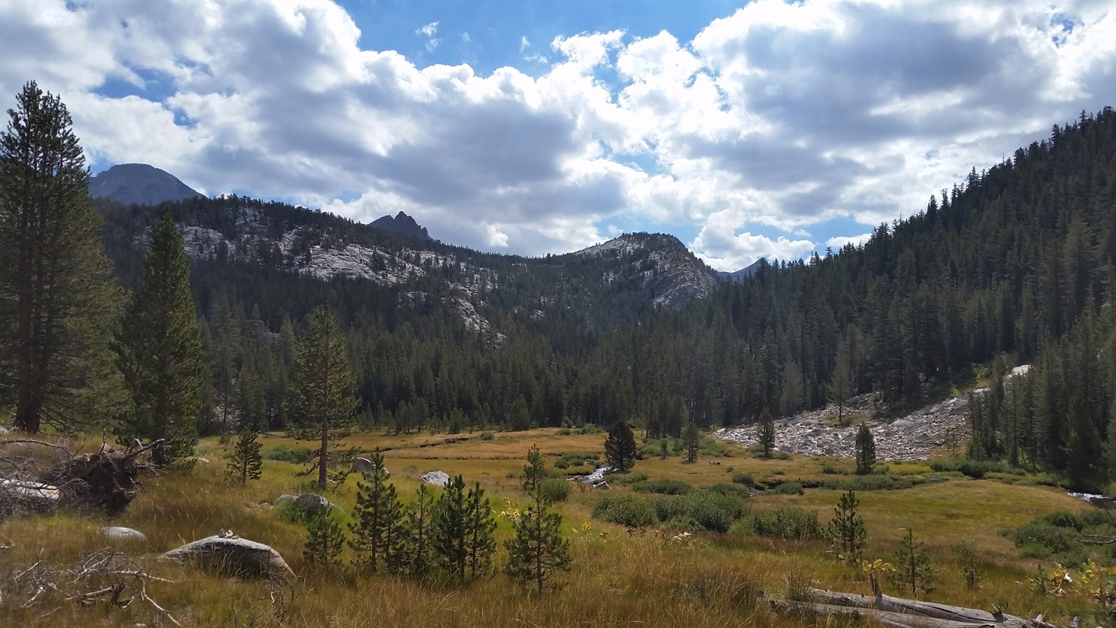
From here we left the day hiking crowds and headed north on the JMT. Big Red had suggested an off trail route from Minaret Lakes to Lake Ediza that we wanted to try to see something new.

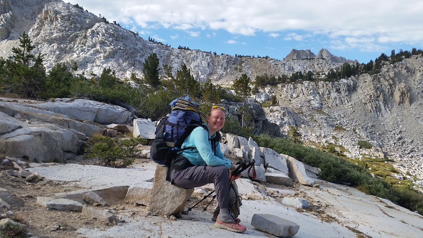
The hike up to Minaret Lakes took longer than either of us expected. We hadn’t planned well and were both hangry by the time we reached the lakes. With a short break, and tuna and countless other food items in our bellies, we were happy again.

Minaret Lake was spectacular! 

We walked around (well scrambled is a more fitting description) the northern part of the lake. By this time it was 3:30. It was later than we would have liked to begin a backcountry adventure but we figured we had 4 hours of daylight and could always turn back.

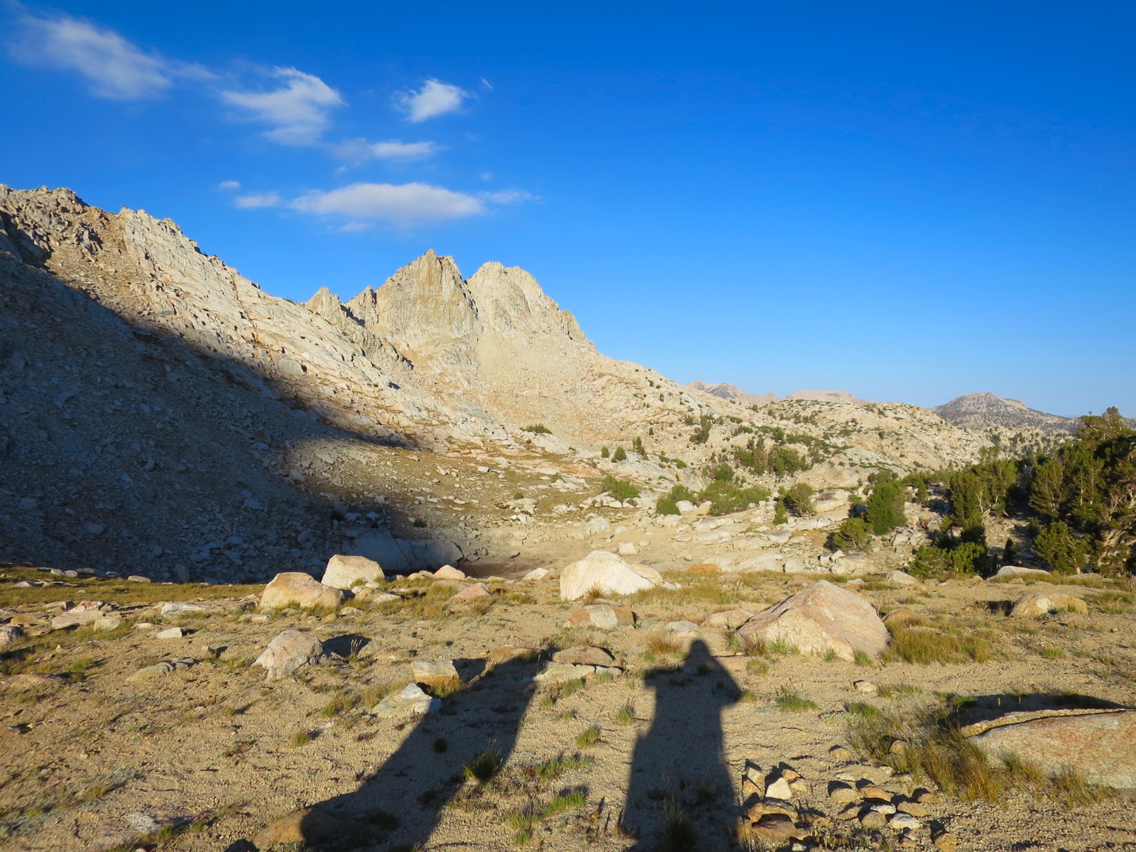
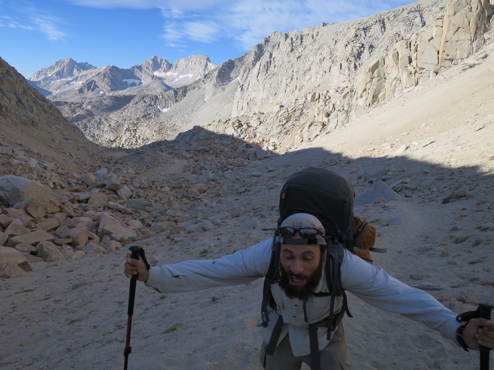
We followed an obvious use trail past the second lake up a meadow. The trail became more faint as we got higher and were walking up loose scree. The faint trail switchbacked up and we followed cairns hoping they were made by people who knew where they were going.

Our calves burned and we were breathing heavily; both of us a little nervous but excited. We communicated well, checking in with one another frequently and decided together which would be the best route to pursue.

We made it to the top of the first climb in 30 minutes. From here we skirted around a puddle and climbed up another shorter incline.

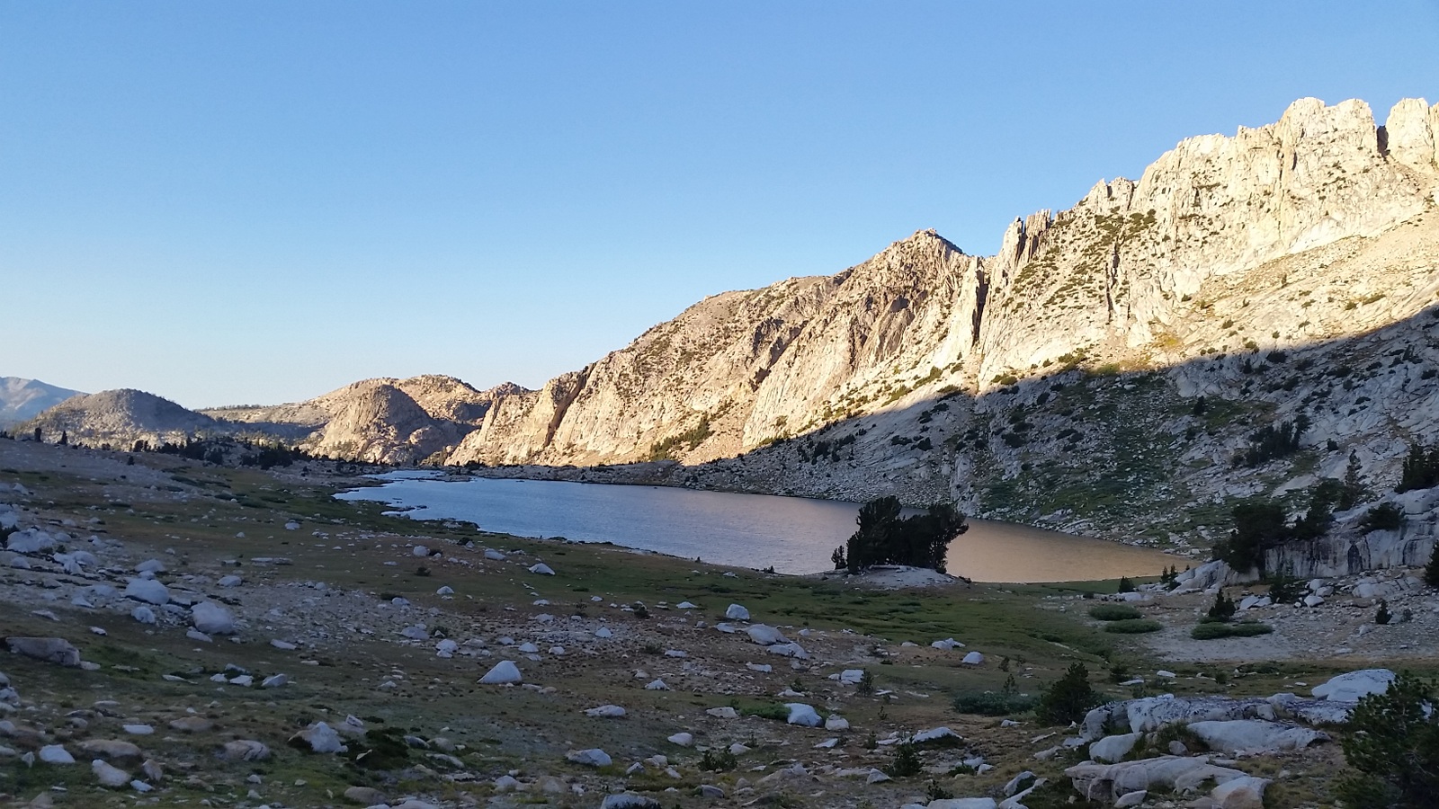
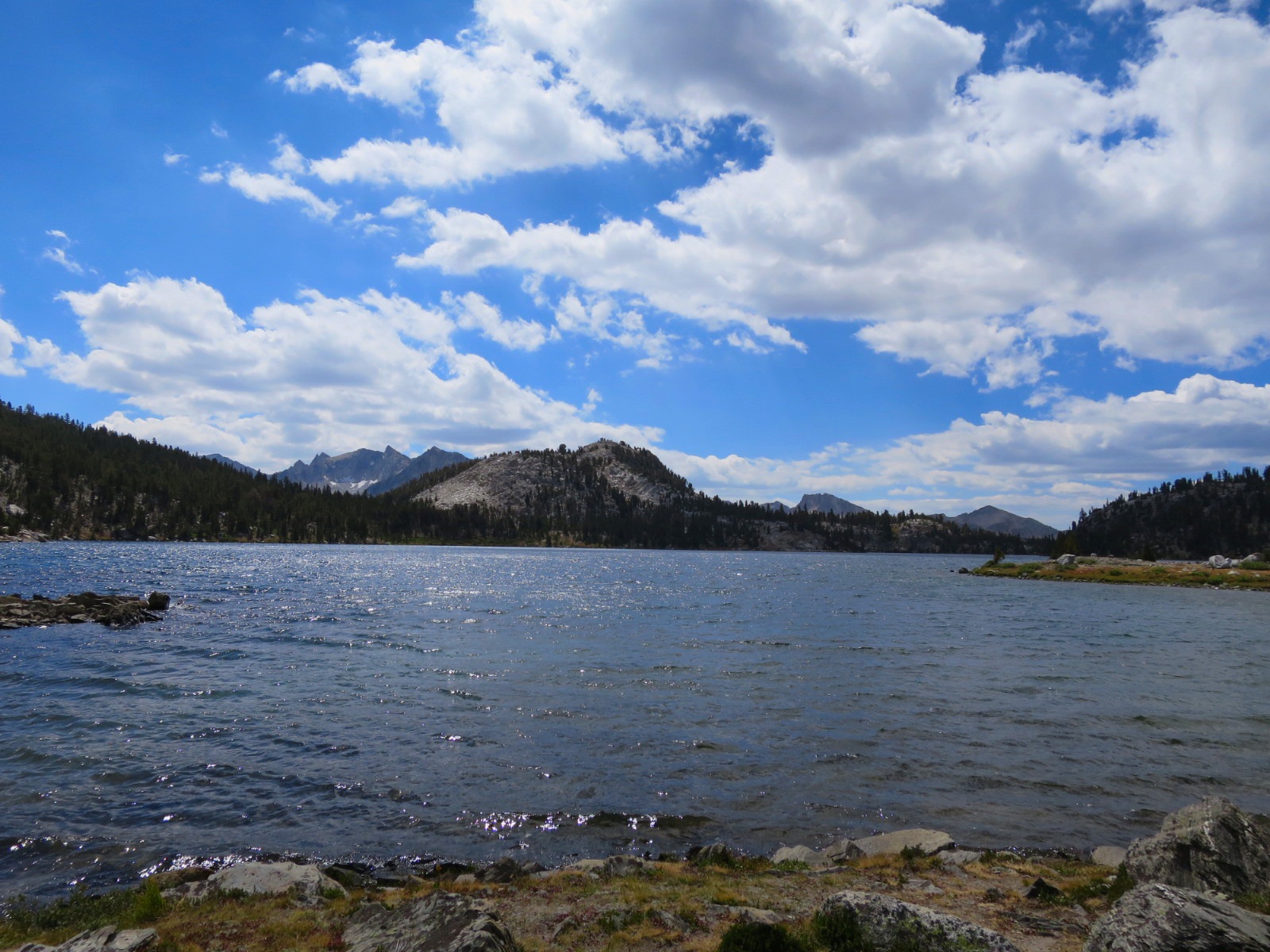
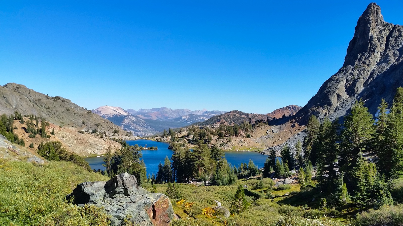
At the top our mouths dropped. There in front of us was a huge beautiful lake set in a bowl of boulders. The clear blue water  of Cecile Lake glistened in the sunlight.

There was one person setting up camp and a family with 2 kids under the age of 5 scampering up the rocks toward us.

Laurie told the youngest one she was doing a great job. She smiled and said thanks. When asked where they were coming from she replied “Portland.”

Gotta love how literal kids are!

We were utterly impressed by this family. It helped settle our nerves to know that kids did what we were about to do.

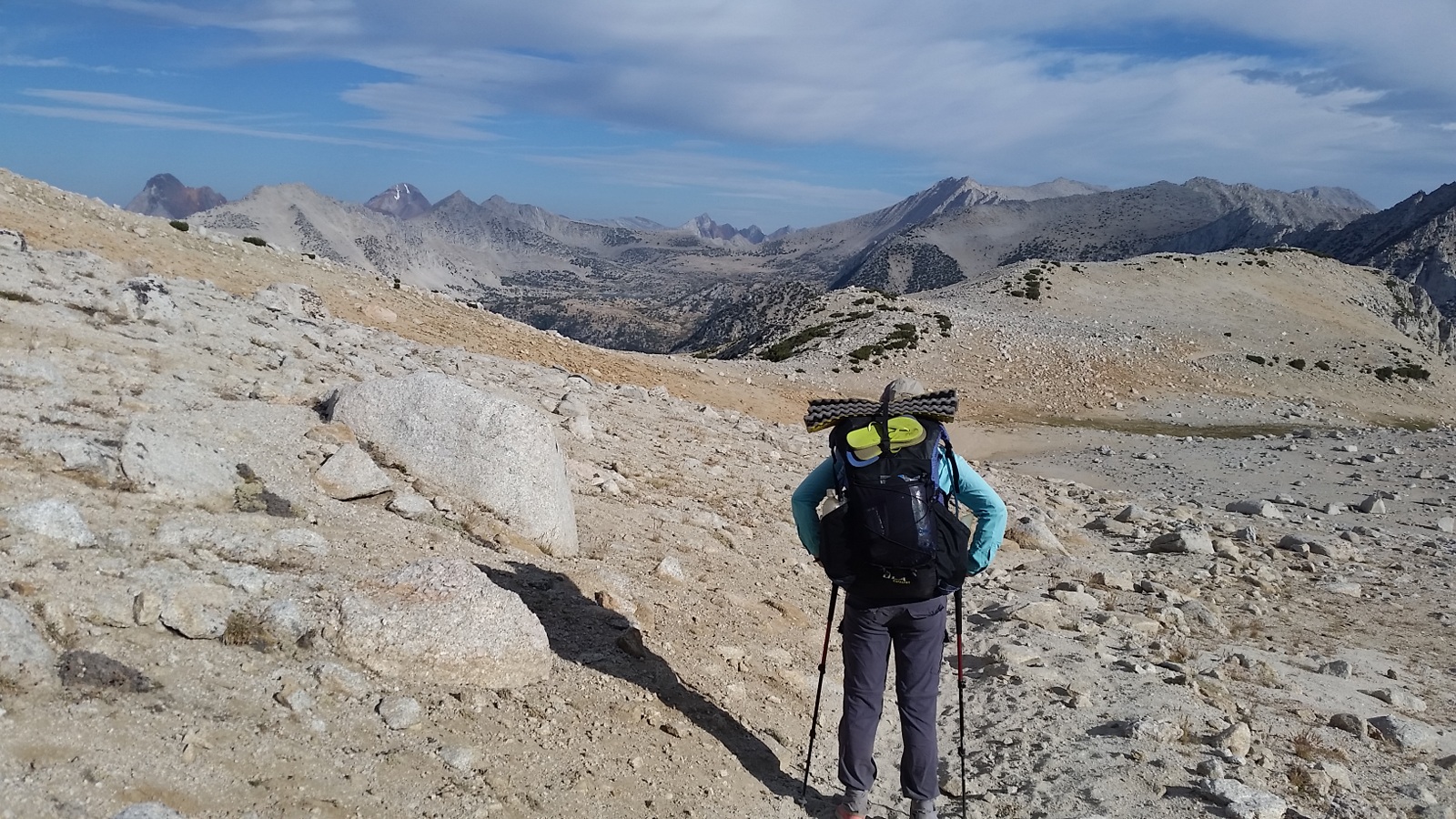
We boulder hoped around the east side of the lake. It was difficult to choose a path but we took our time using our hands more than our poles.

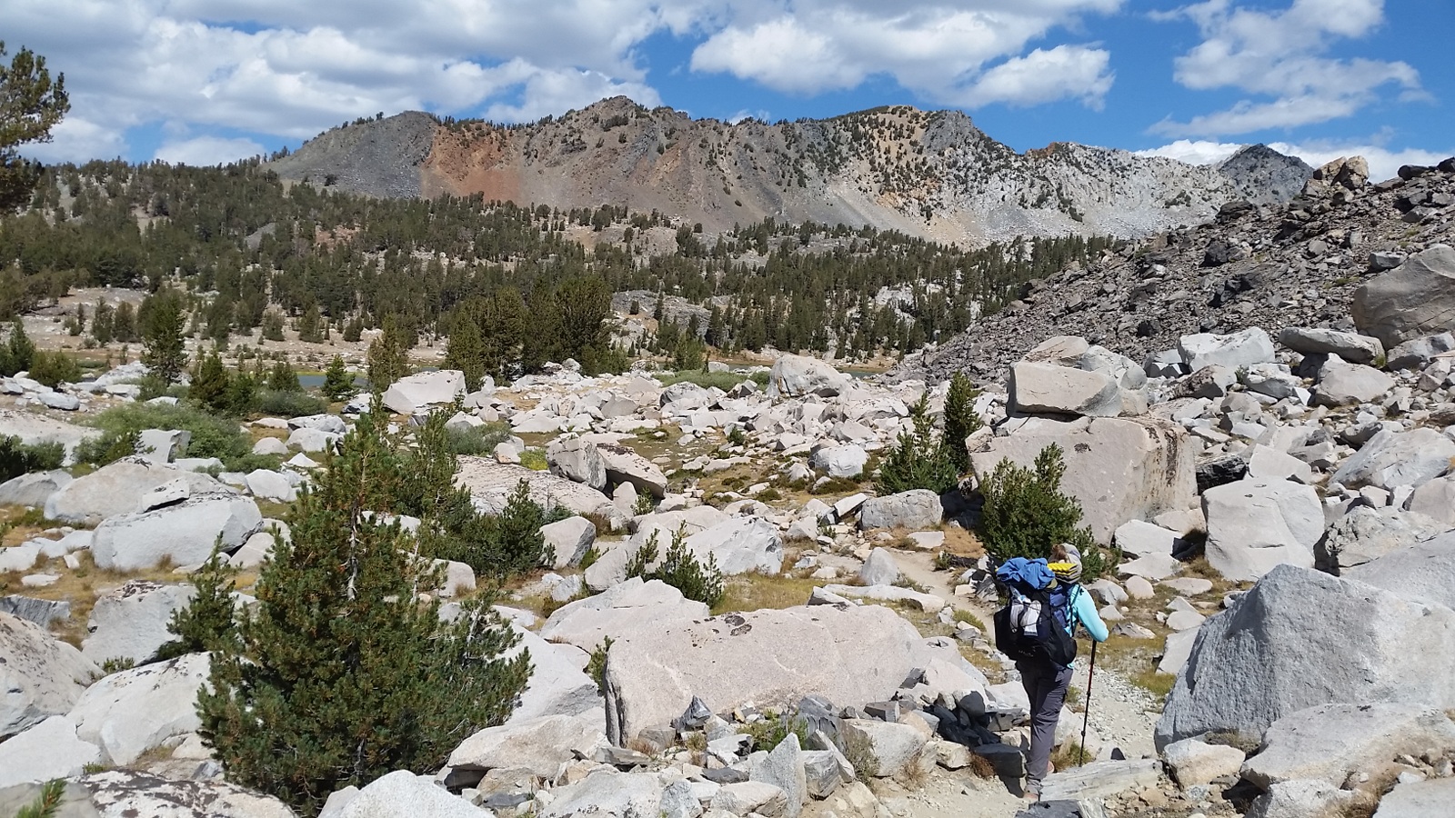
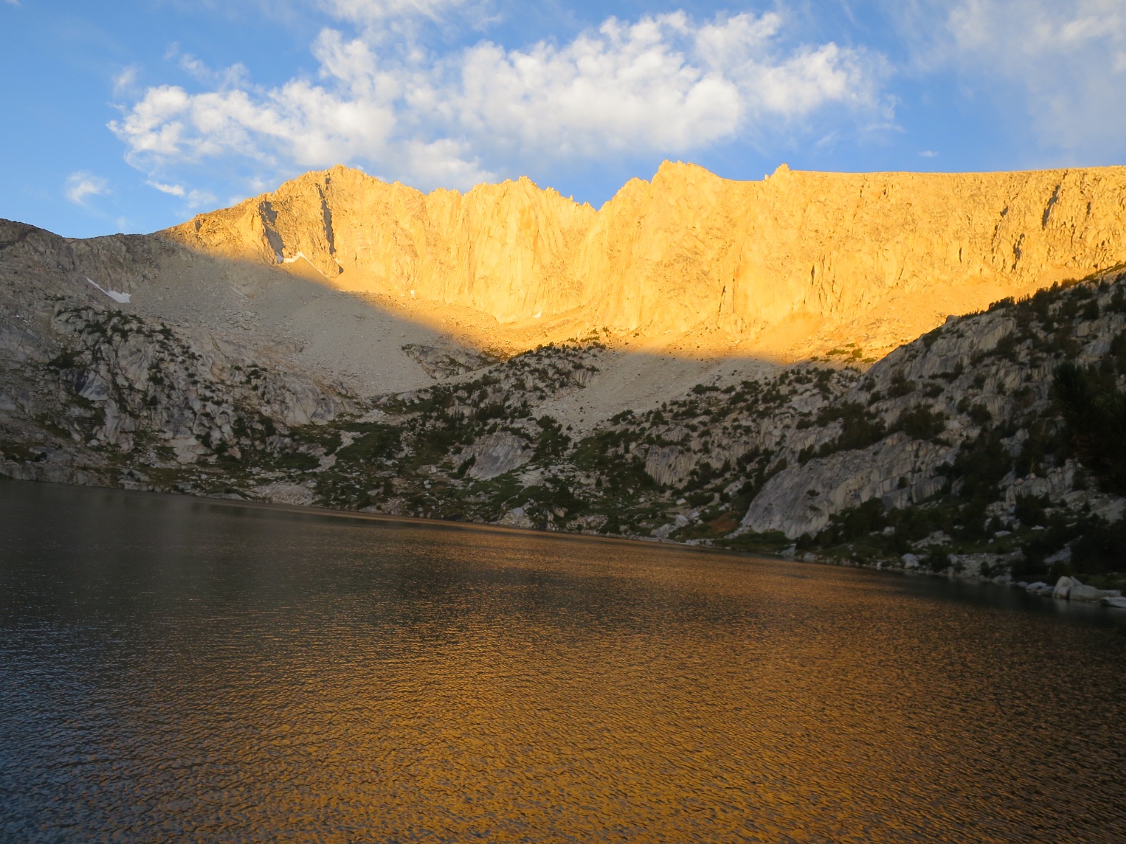
As we neared the outlet we found a faint trail and followed it down a massive scree field. Below us was Iceberg Lake. Quite possibly our new favorite lake in the Sierra.

Unfortunately we couldn’t admire the lake as we stared at our feet as we mindfully placed each foot to prevent from sliding on the loose rock. We could see a trail in a meadow at the far end of the lake.

Looking at the trail was not helpful since there was at least a half mile of loose rocks between us and the trail. Laurie kept reminding herself to focus on the 10 feet in front of her. 

Like in life, it is nice to have a goal or direction but often all we can change is the near future. And today in this boulder field, the near future were the rocks 10 feet in front of us.

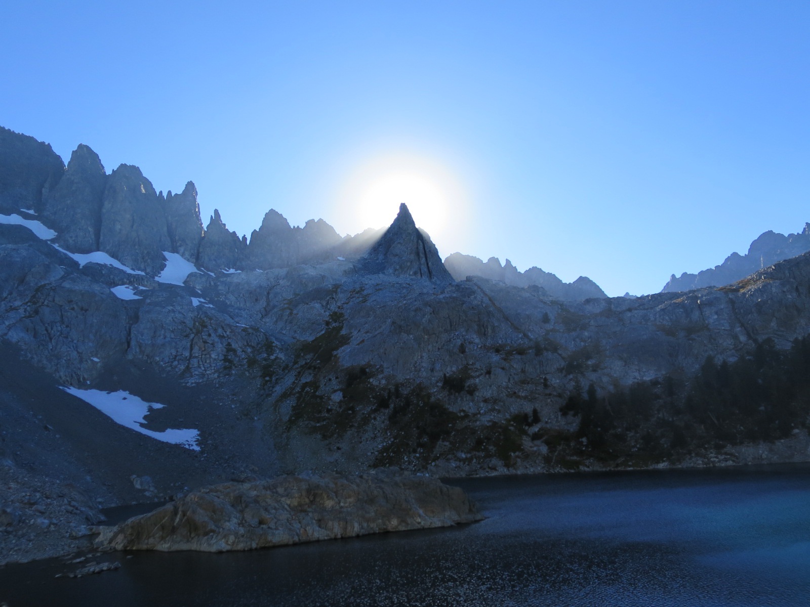
Eventually we made it through. The sun had dipped behind one of the rocky spires of The Minarets, creating sections of shade. 

Once in the meadow we looked back at where we had come from. It looked like a scree wall, not something either of us would consider attempting to scramble up had we not known there was a trail.

We had planned to hike all the way to Ediza Lake but this lake was too nice to leave. Plus, we figured Ediza was easier to get to and would probably have more people.

We washed our feet and faces in the lake and since the water wasn’t too cold, Laurie dunked her entire body in. While initially chilly, a quick dip at the end of the day is quite refreshing.

We ate dinner on a rock watching the last evening light leave the western tip of the rocky spires.

This lake is magical. Laurie felt happy and carefree. We wish there was a way to come to this happy place more often. 

The fresh air, stary sky and quiet days have a way of making our hearts feel full and spirits high. We both hope we can hold onto a little bit of this when we return to jobs and city life. Or perhaps, we may end up moving out of the city to a place that allows us to feel this serenity.

Who knows. As for now, we will savor these sensations and emotions.

Tonight we are grateful for unexpected cross country adventures and new lakes.

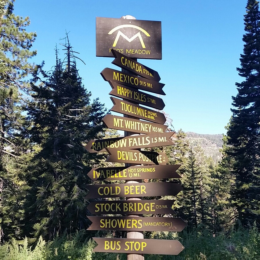
Laurie gets her milkshake
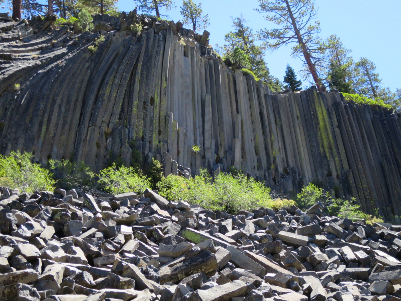
Devils Postpile

Beautiful Minaret Lake

Second Minaret Lake

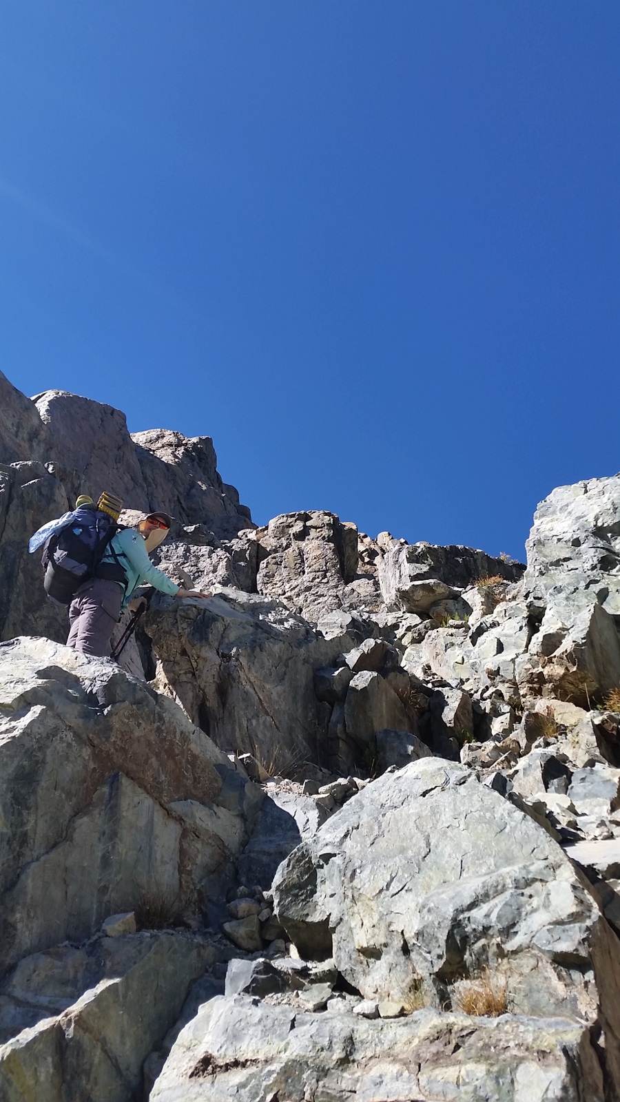
No trail? Just go up!
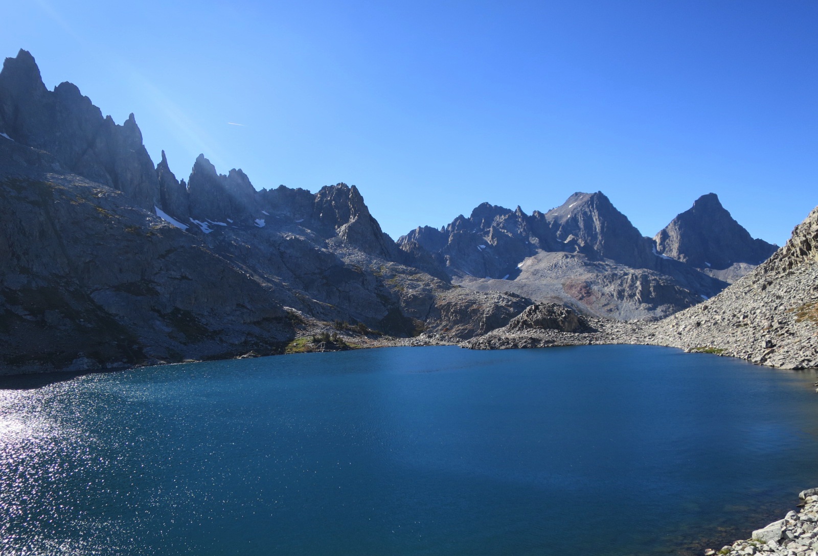
Cecile Lake

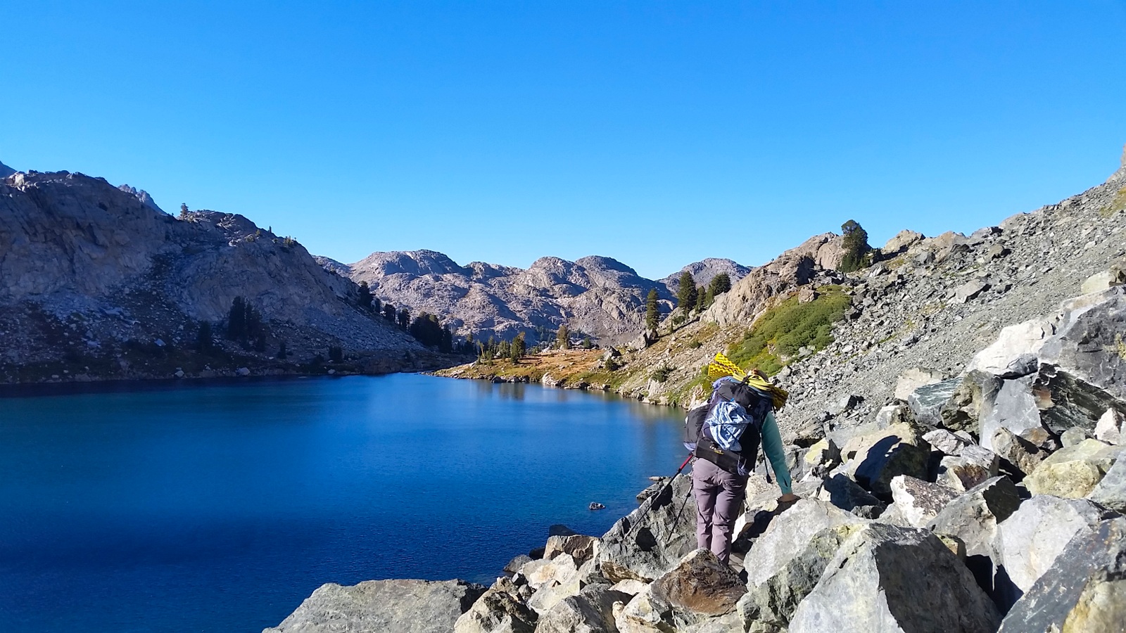
Hiking down to Iceberg Lake

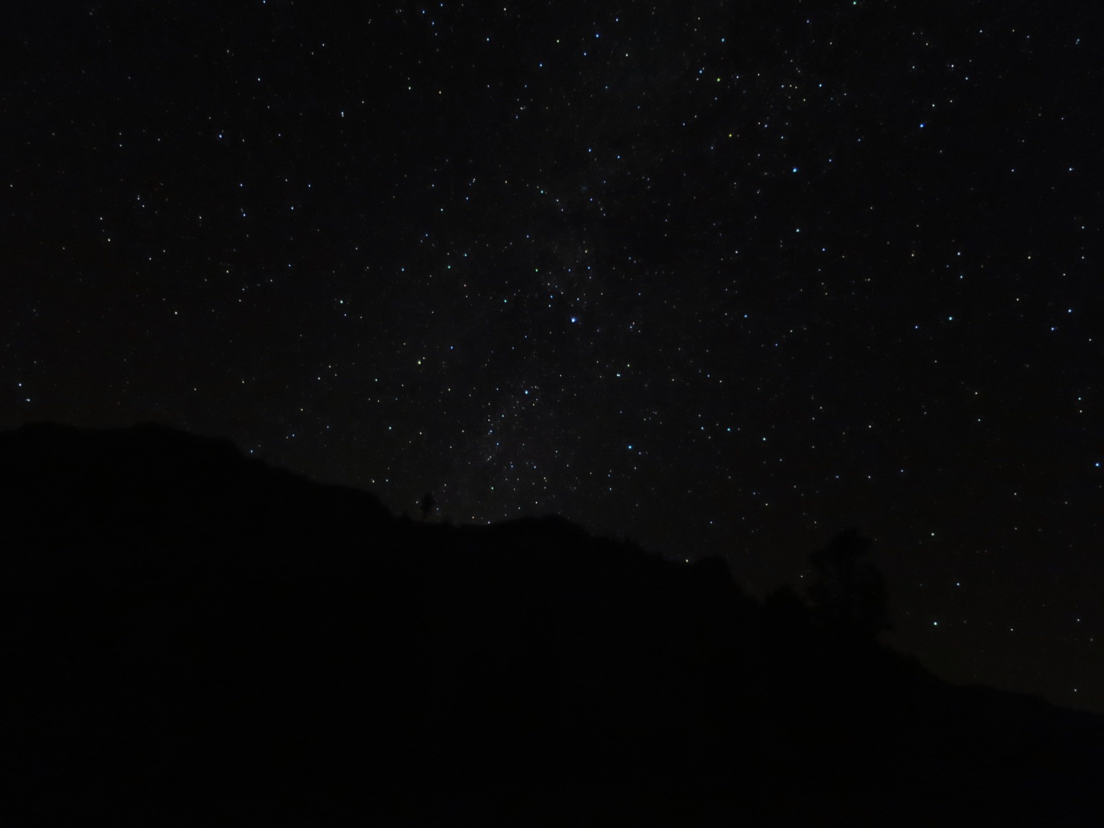
The stars in the Sierras are fabulous!

Day 150 – a blustery day on the John Muir Highway

August 31, 2016

Silver Pass Lake (mile 884) to Crater Creek (mile 903.9)

Miles: 19.9

Our total miles: 2268.9

It was windy last night, but not very cold. And despite sleeping near the lake, our tent and sleeping bags were dry. 

We were slow to get going today. Knowing we had only 20 miles to hike gave us permission to sleep in a little. 

Around 7am we stepped out of our tent. As we finished packing a person went to retrieve their bear can from the nice tent site next to a boulder. 

Andy went down the hill toward him, said hello, and politely asked him not to store his bear can near tent sites so others can use them. 

“I didn’t notice that I had done that.” 

Andy smiled and said have a good day, but nothing else. He wasn’t looking for an argument. He simply wanted this person to be more aware when storing his bear can.

Typically, PCT hikers hike later into the evening (stopping around 7 or 8pm) compared to other backpackers, including JMTers, and small things like this bother us. Particularly when we get to camp tired and hungry. 

We walked toward the trail, still in the shadows of the hills. The sun was just starting to light up the tops of the jagged mountains around us.

As we neared Silver Pass the wind intensified. Big grey clouds dominated the sky, but we weren’t terribly worried. 

We were in awe of the beauty around us. Clear blue lakes were surrounded by pointy granite peaks. One look and it’s easy to understand why so many people hike along the John Muir Trail – in its entirety or in parts.

Today we saw at least 100 other hikers, 98% were going southbound. We understand and accept that many people hike along this trail. Andy has dubbed it the John Muir Highway instead of the John Muir Trail.

We expected the crowds, but were surprised that many hikers either didn’t know or didn’t care to give the right of way to hikers going uphill. 

Do we hold our ground and not stop? Do we merge but say something? Laurie found herself playing Chicken with other hikers from time to time – especially the younger ones. 

We don’t mind giving way to hikers here and there but when we do this for miles it’s hard to get into a groove and make progress!

Hiking amongst JMTers provided an opportunity for each of us to reflect on how much we have changed since our respective JMT hikes in 2012. 

Laurie carries a much smaller backpack and wears trail runners rather than boots while Andy carries a stove and cares more about comfort than being ultralight. It is nice to see that we have had a good influence on one another’s backpacking style.

When we reached beautiful Lake Virginia the wind was unrelenting. White caps covered the surface of the water. 

By the time we filled up our bottles we were ready to leave and get warm again. 

“But it’s so pretty here. Let’s stay and have lunch” Laurie proposed. 

We put on our warm layers, found a somewhat protected spot and enjoyed a beautiful view of the lake from afar. 

Laurie set up her camera for a time lapse while we ate lunch and expanded our to do lists. Before we knew it 30 minutes had passed.

No matter though, we only had 12 miles to camp and most of that was on gentle downhill trail.

It was fun hiking the JMT north and seeing how much of it we both remembered when we hiked it southbound in 2012.

Around 4:30pm we neared Deer Creek. As we collected water and took a short break we counted the number of tents already set up. 

Compared to other thru hikers we stop early, but compared to traditional backpackers we hike late into the evening.

It was slightly unnerving to see so many tents set up so early. We wondered if there would be space for us at Crater Creek less than 3 miles away.

As we approached camp we noticed only one other person here – a northbound JMT hiker. You don’t see too many of those. Over 90% of JMTers hike southbound. 

We set up our tent, chatted for a while, ate cheese, and went to the creek to clean our feet.

When Andy took off his socks he noticed a hole in the left one. He had a hole in his other brand new pair (in the same exact spot) yesterday too. 

We’re not sure what’s happening. As a precaution Andy cut his big toe nail. Hopefully this helps. 

After dinner we got cozy into our sleeping bags. Not a smart move because it makes it harder to get out and brush our teeth.  

But we did, and we are in our sleeping bags again. It’s only 8:30 and though we have to catch up on our blog we hope to be asleep by 9pm.

Tonight we are grateful for beautiful blue lakes and a relatively quiet campsite along the JMT highway.  

Silver Pass Lake

Beautiful Lake Virginia

Day 149 – leftovers, altitude and easy creek crossings

August 30, 2016

Ruby lake to Silver Pass Lake (mile 884)

Miles: 20.9 (14.4 to PCT + 1.3 PCT miles south to VVR junction + 5.2 PCT miles north)

Our total miles: 2249

We slept well under a blanket of stars. We didn’t set an alarm and woke up around 6:15, in time to watch the morning light kiss the granite cliffs around Ruby Lake.

We were walking by 7:15. Our packs didn’t feel much lighter than yesterday but our bodies were rested. As we started to climb up toward Mono Pass Laurie felt her heart racing. 

Ah yes, altitude.

Our max elevation during the last 2.5 months was 6ooo or 7000 feet. Suddenly we were at 10,500 feet going up to 12,000. Our bodies were no longer acclimatized.

Fortunately we both acclimatize quickly. We anticipate that in a few days we would feel like mountain goats again. 

But for now, we took it slow, mindfully placing each foot so as not to slip on the sand covered granite steps.

Today was beautiful! Narrow whispy looking clouds were scattered across the pale blue sky.

We climbed up to Mono Pass via sandy switchbacks. Our lungs screamed everytime we took a drink as the moment was dedicated to drinking rather than breathing.

Mono Pass was desolate, the only thing around was Summit Lake. It looked like the Sahara desert or maybe another planet (we have never been to either of these places but assume they look this way).

From here we descended, past other lakes, down toward Mono Creek. We took a break about a mile after the pass to enjoy hard boiled eggs and potatoes. Leftovers are delicious but boy are they heavy!

We crossed a few steams wondering out loud what they would have looked like in early June.

We made a wrong turn and walked an exta 1.2 miles to Fourth Recess Lake. The sign at the junction was confusing and we both questioned our decision when the trail started to climb. 

Since we were off the PCT our trail maps and apps were useless but we had taken a picture of Big Red’s Topo map. We were trying figure out where we were in relation to creek crossings when a group of 4 guys came around the bend. They confirmed we were on the wrong trail but encouraged us to go to the lake since we were so close.

It was beautiful! So beautiful in fact that Laurie decided she had to go for a swim. The water was surprisingly tolerable. Another great reason to visit the Sierras in September, the lakes are not frozen and actually swim-able.

We retraced our steps and continued down on the correct trail. We walked through many piles of horse poop, sand and rocks. We walked past quivering aspen trees and in and out of tree cover and meadows. It was pretty and hot.

Just before 3 pm we intersected the PCT. We smiled. We had made it back to our familiar 18 inch wide string of dirt we now call home.

We hiked south for 1.3 miles to the junction where 2.5 months earlier we had veered left toward Lake Edison and the ferry to VVR. 

We touched the sign and spun around. From this very point we had 406.3 miles to go to complete our thru hike!

We started our climb up toward Silver Pass. Originally we had hoped to make it another 11 miles to Virginia Lakes but given that it was already 4:30, we made a new plan.

We easily crossed each stream, trying to figure out which ones were the “waterfalls” that people described in early June. Some of the creeks were now stagnant pools in a river bed. It is amazing how much can change in a few months. 

We stopped to talk with a guy named Al. We met him originally on our way down to the VVR junction when he asked about camping and water options up the trail. We consulted Guthook and Halfmile and gave him info.

Now at 6 pm we passed him again as we all climbed up toward Silver Pass. He was fascinated by the apps and impressed with our goal of getting to Silver Pass Lake. We had a little less than 2 hours of daylight and 3.8 miles to go. We don’t believe we’re much faster until other backpackers tell us we’re crazy 🙂 

We picked up our speed as we climbed up the granite steps toward the pass.

We got to Silver Lake at 7:35. The evening glow was just fading from the hills to the east. We went to the lake to get water and wash the dirty sand from our feet and legs. Despite wearing long pants, gaiters and socks our feet (and Andy’s legs) get filthy!

We searched for a flat spot amongst the few trees at the outlet of the lake. We had asked a southbound JMT hiker if they had seen people camping at this lake and they said no. Surprisingly everywhere we looked we saw tents.

We saw a nice flat spot protected from the wind but someone had chosen to store their bear can there. Laurie was tempted to move it but Andy didn’t want to touch other people’s things. 

So we settled for a spot with a small root in the midle and set up the tent just as the final light left the sky. Andy cooked as Laurie inflated the pads by the light of our headlamps. 

We can tell the days are getting shorter. In the last week, even in northern Washington, we had relied on the light of our headlamps more than the rest of our entire hike.

We enjoyed a delicious dinner of dehydrated leftover pasta and then lay in our sleeping bags staring up at the Milky Way.

Tonight we are grateful for easy creek crossings and opportunities to gaze at the Milky Way.

Ruby Lake sunrise

Gasping for air

Mono Pass and beyond

Laurie being Laurie at 4th Recess Lake

Climbing toward Silver Pass